Working with map objects
As you set up your map, you can decide how detailed you want the objects on it to be. That's what the control block is for. Move the slider to the right to add detail or to the left to remove it.
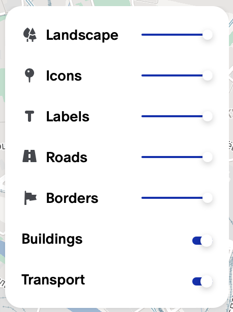
Here are the categories you can set a level of detail for:
- Landscape — green areas, parks, and building areas and types.
- Icons — markers for cultural and relaxation spots, memorials, entertainment and sporting locations, stores, and more.
- Labels — text over population centers, regions, and streets.
- Roads — where you'll find all the vehicles.
There are two switches below the block:
- Buildings — shows/hides buildings.
- Transport — shows/hides public transportation routes, stops, and stations.
Adjustments for smaller elements (icons, labels) show up well at larger scales, while adjustments for larger elements (borders, roads) show up better at smaller scales.